
QUANTIFIER
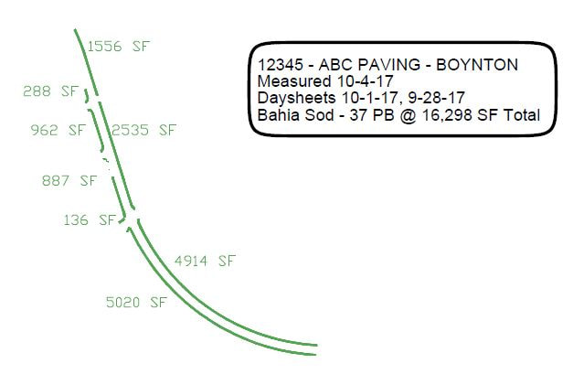
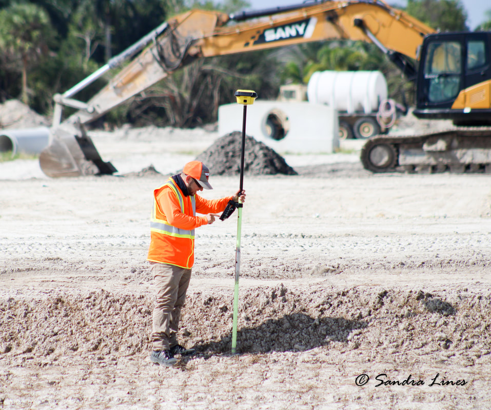
Our Quantifiers measure surface area by creating an electrical topographic design of the installed areas through co-ordinate geometry collected by a GPS tracking and mapping unit. Then the raw data is collected in the field through a land design program called MicroStation (AutoCAD). By creating segment lines adjoined by the data points collected, polygonal chains are made that close off the boundaries and then incorporate break lines for contouring to intersect to the chain. When all this drafting is complete, the quantifiers use an automated flood measurement tool within MicroStation to quantify each block in square footage. Then it's as simple as adding up all the numbers and create a summary report which is provided to our customers for billing.
|
|
*The above is an example of what our customers are provided at billing